
NGEE Arctic
Next-Generation Ecosystem Experiments
Advancing the predictive power of Earth system models through understanding
of the structure and function of Arctic terrestrial ecosystems
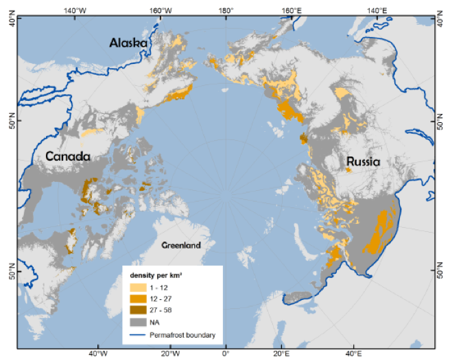
PeRL: A circum-Arctic permafrost region pond and lake database
PeRL: A circum-Arctic permafrost region pond and lake database
January 4th, 2018
Waterbody density per km2 for waterbodies with surface areas of between 1 and 100 ha within permafrost landscape units. Permafrost boundary was derived from the regional databases.