
NGEE Arctic
Next-Generation Ecosystem Experiments
Advancing the predictive power of Earth system models through understanding
of the structure and function of Arctic terrestrial ecosystems
Multi-sensor visible, spectral, and thermal Unmanned Aerial System (UAS) flights in Nome
Multi-sensor visible, spectral, and thermal Unmanned Aerial System (UAS) flights in Nome
January 4th, 2018
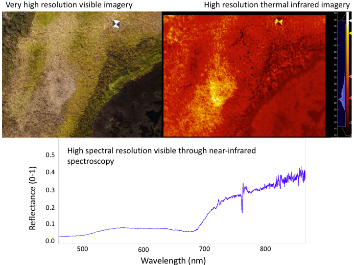
Example imagery and spectral data over a section of a thaw pond near Council, AK from the Osprey UAS platform. A very high spatial resolution image from the camera over the edge of the thaw pond (top left), and a paired thermal infrared image with temperature scale (top right)