
NGEE Arctic
Next-Generation Ecosystem Experiments
Advancing the predictive power of Earth system models through understanding
of the structure and function of Arctic terrestrial ecosystems
Mapping Arctic Plant Functional Type Distributions in the Barrow Environmental Observatory Using WorldView-2 and LiDAR Datasets
Mapping Arctic Plant Functional Type Distributions in the Barrow Environmental Observatory Using WorldView-2 and LiDAR Datasets
October 17th, 2016
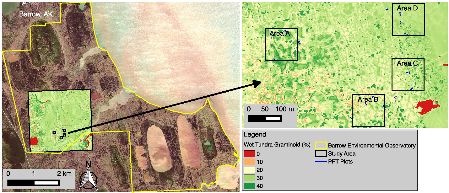
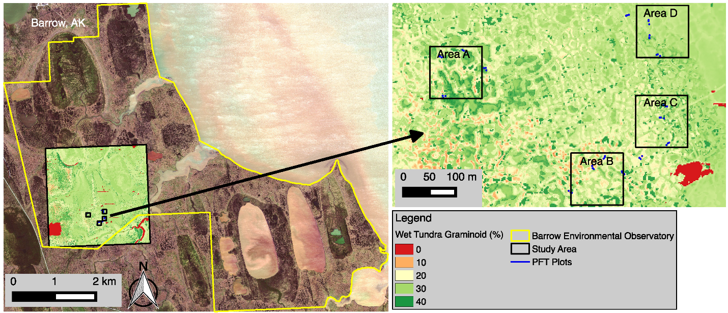
Figure 1. WorldView-2 true color image of our study region showing the estimated percent of wet tundra graminoids for Areas A, B, C, and D.

