
NGEE Arctic
Next-Generation Ecosystem Experiments
Advancing the predictive power of Earth system models through understanding
of the structure and function of Arctic terrestrial ecosystems
Understanding inundation and drainage patterns of ice-wedge polygons
Understanding inundation and drainage patterns of ice-wedge polygons
February 25th, 2021
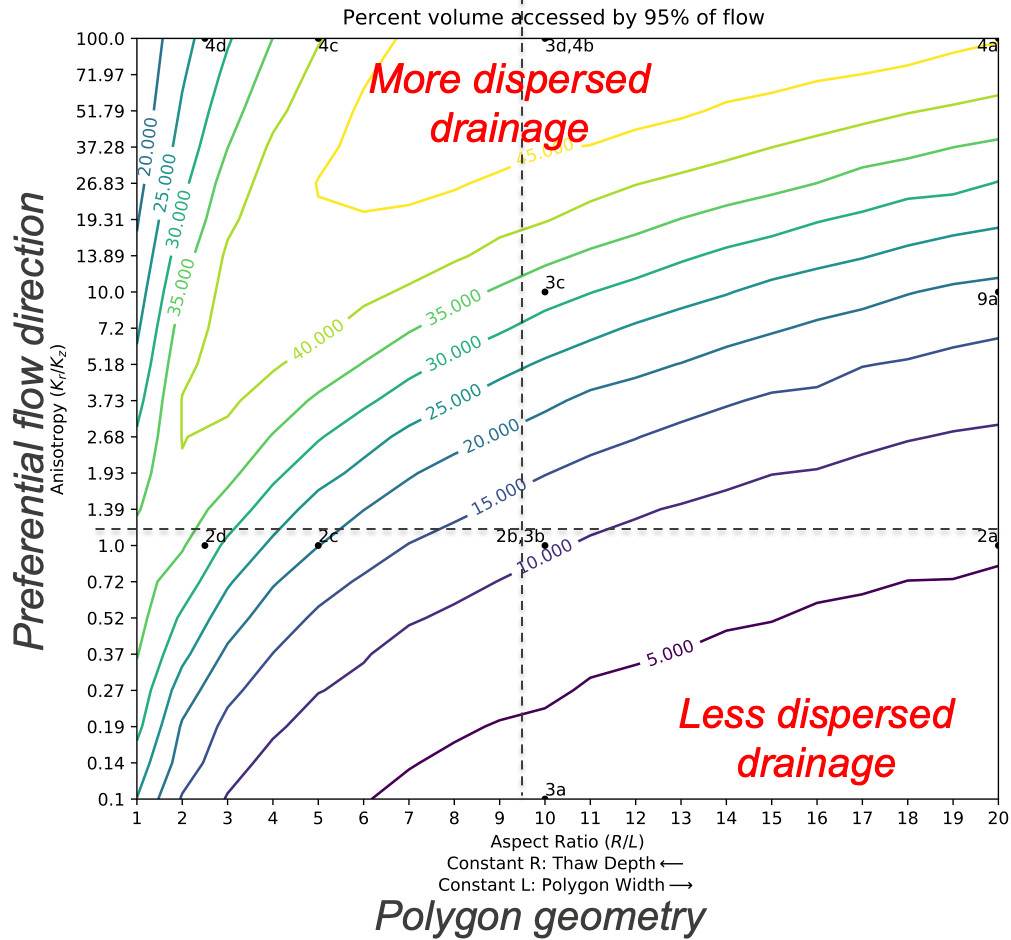
Contour map of the percent of the polygon thaw layer accessed by 95% of the flow as a function of polygon aspect ratio (radius/thaw depth) and hydraulic conductivity anisotropy (horizontal divided by vertical hydraulic conductivity).
