
NGEE Arctic
Next-Generation Ecosystem Experiments
Advancing the predictive power of Earth system models through understanding
of the structure and function of Arctic terrestrial ecosystems
Identifying polygonal ground in arctic regions using GLCM texture features for random forest classification
Identifying polygonal ground in arctic regions using GLCM texture features for random forest classification
February 25th, 2021
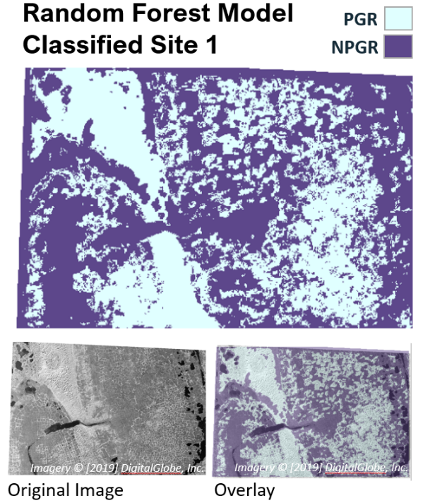
The raster image (below) is a classified map using the random forest model where GLCM contrast, homogeneity, dissimilarity, and entropy are used to predict NPGR (non-polygonal ground regions, purple) or PGR (polygonal ground regions, blue) with 92% overall accuracy.
